
Illaroo topographic map
Interactive map
Click on the map to display elevation.
About this map
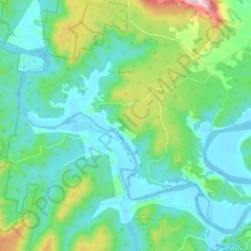
Name: Illaroo topographic map, elevation, terrain.
Average elevation: 358 ft
Minimum elevation: -20 ft
Maximum elevation: 1,516 ft
Other topographic maps
Click on a map to view its topography, its elevation and its terrain.
Budjong Vale
Australia > New South Wales > Budjong Vale
Budjong Vale, Shoalhaven City Council, New South Wales, Australia
Average elevation: 676 ft