
Golestan National Park topographic map
Interactive map
Click on the map to display elevation.
About this map
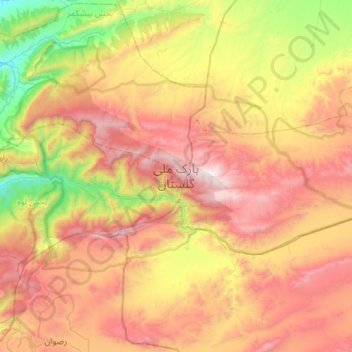
Name: Golestan National Park topographic map, elevation, terrain.
Average elevation: 4,094 ft
Minimum elevation: 1,033 ft
Maximum elevation: 7,667 ft
The park is located in the eastern Alborz (Elburs) Mountains range and the western edge of the Kopet Dag range. It comprises 91,890 ha. Elevations in the park range from 1,000–1,400 metres (3,300–4,600 ft) above sea level.