
Chora topographic map
Interactive map
Click on the map to display elevation.
About this map
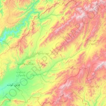
Name: Chora topographic map, elevation, terrain.
Location: Chora, Urōzgān, Afghanistan (32.44044 65.93513 33.32817 66.56881)
Average elevation: 7,346 ft
Minimum elevation: 3,799 ft
Maximum elevation: 13,346 ft
Other topographic maps
Click on a map to view its topography, its elevation and its terrain.