
Eilsleben topographic map
Interactive map
Click on the map to display elevation.
About this map
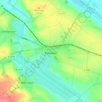
Name: Eilsleben topographic map, elevation, terrain.
Location: Eilsleben, Obere Aller, Börde, Sachsen-Anhalt, Deutschland (52.12419 11.18912 52.17193 11.25378)
Average elevation: 479 ft
Minimum elevation: 390 ft
Maximum elevation: 640 ft