
Horseshoe Falls topographic map
Interactive map
Click on the map to display elevation.
About this map
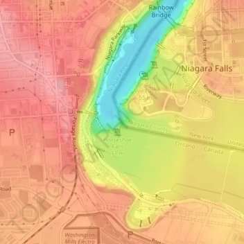
Name: Horseshoe Falls topographic map, elevation, terrain.
Average elevation: 568 ft
Minimum elevation: 318 ft
Maximum elevation: 686 ft
Other topographic maps
Click on a map to view its topography, its elevation and its terrain.
American Falls
Vereinigte Staaten von Amerika > New York > Niagara Falls
American Falls, Niagara Falls, Niagara County, New York, NY 14303, Vereinigte Staaten von Amerika
Average elevation: 558 ft