
Thame topographic map
Click on the map to display elevation.
About this map
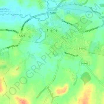
Name: Thame topographic map, elevation, terrain.
Location: Thame, South Oxfordshire, Oxfordshire, England, United Kingdom (51.71792 -1.00432 51.76071 -0.94439)
Average elevation: 243 ft
Minimum elevation: 194 ft
Maximum elevation: 335 ft
Other topographic maps
Click on a map to view its topography, its elevation and its terrain.
Sonning Eye
United Kingdom > England > Oxfordshire > South Oxfordshire > Dunsden Green
Average elevation: 167 ft