
夏河县 topographic map
Interactive map
Click on the map to display elevation.
About this map
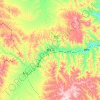
Name: 夏河县 topographic map, elevation, terrain.
Location: 夏河县, 拉卜楞镇, 夏河县, 甘南藏族自治州, 甘肃省, 中国 (35.03839 102.35964 35.35839 102.67964)
Average elevation: 11,043 ft
Minimum elevation: 8,871 ft
Maximum elevation: 13,789 ft
距县城10公里。桑科草原属于草甸草原,平均海拔在3000米以上,草原面积达70平方公里,是甘南藏族自治州的主要畜牧业基地之一。