
Kiekberg topographic map
Interactive map
Click on the map to display elevation.
About this map
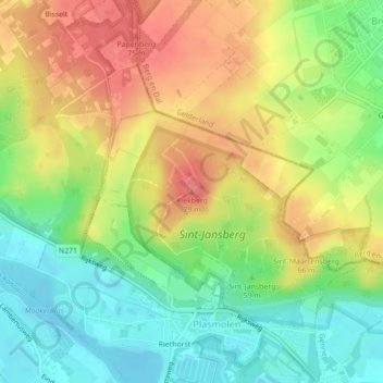
Name: Kiekberg topographic map, elevation, terrain.
Average elevation: 131 ft
Minimum elevation: 20 ft
Maximum elevation: 249 ft
Other topographic maps
Click on a map to view its topography, its elevation and its terrain.
Sint-Jansberg
Nederland > Limburg > Mook en Middelaar
Sint-Jansberg, Riethorsterweg, Plasmolen, Mook en Middelaar, Limburg, Nederland, 6586AC, Nederland
Average elevation: 115 ft