
Thank you for supporting this site ❤️
Make a donation
Make a donation
Gear up for your next adventure:
As an Amazon Associate, this site earns from qualifying purchases at no extra cost to you.
Tampomas topographic map
Click on the map to display elevation.
Thank you for supporting this site ❤️
Make a donation
Make a donation
Gear up for your next adventure:
As an Amazon Associate, this site earns from qualifying purchases at no extra cost to you.
About this map
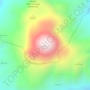
Name: Tampomas topographic map, elevation, terrain.
Location: Tampomas, Hutan, Sumedang, West Java, Java, Indonesia (-6.76451 107.96036 -6.76441 107.96046)
Average elevation: 4,094 ft
Minimum elevation: 3,084 ft
Maximum elevation: 5,486 ft
Thank you for supporting this site ❤️
Make a donation
Make a donation
Gear up for your next adventure:
As an Amazon Associate, this site earns from qualifying purchases at no extra cost to you.