
Rancocas topographic map
Interactive map
Click on the map to display elevation.
About this map
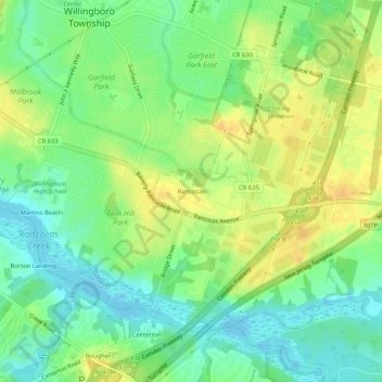
Name: Rancocas topographic map, elevation, terrain.
Location: Rancocas, Burlington County, New Jersey, 08073, USA (39.99067 -74.88683 40.03067 -74.84683)
Average elevation: 46 ft
Minimum elevation: -23 ft
Maximum elevation: 89 ft