
Hollingsworth Bluff topographic map
Interactive map
Click on the map to display elevation.
About this map
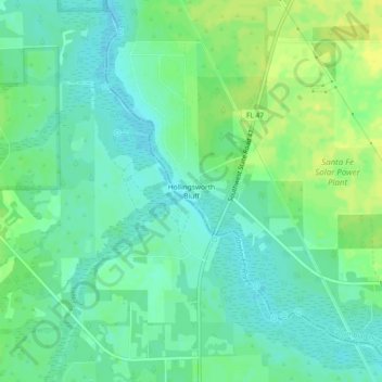
Name: Hollingsworth Bluff topographic map, elevation, terrain.
Location: Hollingsworth Bluff, Columbia County, Florida, United States (29.84951 -82.76289 29.88951 -82.72289)
Average elevation: 46 ft
Minimum elevation: 20 ft
Maximum elevation: 75 ft
Other topographic maps
Click on a map to view its topography, its elevation and its terrain.
Lake City
United States > Florida > Columbia County
Lake City, Columbia County, Florida, United States
Average elevation: 157 ft
Lulu
United States > Florida > Columbia County
Lulu, Columbia County, Florida, 32061, United States
Average elevation: 144 ft
Fort White
United States > Florida > Columbia County
Fort White, Columbia County, Florida, 32038, United States
Average elevation: 72 ft
Lake City
United States > Florida > Columbia County > Lake City
Lake City, Columbia County, Florida, 32026, United States
Average elevation: 157 ft