Geolocate

Vejer de la Frontera topographic map

Click on the map to display elevation.

About this map
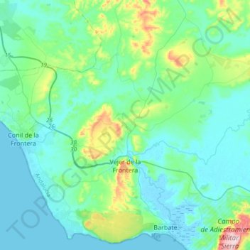
Name: Vejer de la Frontera topographic map, elevation, terrain.

Location: Vejer de la Frontera, La Janda, Cádiz, Andalusia, Spain (36.20590 -6.07971 36.37475 -5.78228)

Average elevation: 174 ft

Minimum elevation: -10 ft

Maximum elevation: 1,037 ft

Gear up for your next adventure:

📖Nature Tracking Books - Learn to track wildlife and terrain
🥘Titanium Cookware - Durable, featherlight pots and pans for backpacking
🧤Hiking Gloves - Protective gloves for rugged trails
📷Action Cameras - Rugged cameras to document your journeys across rugged terrain
🔌Solar Panel Charger - Charge gear sustainably outdoors

As an Amazon Associate, this site earns from qualifying purchases at no extra cost to you.