
Chiché topographic map
Interactive map
Click on the map to display elevation.
About this map
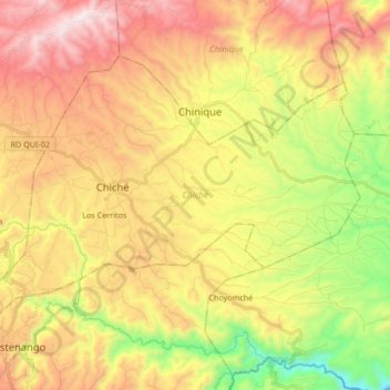
Name: Chiché topographic map, elevation, terrain.
Location: Chiché, Quiché, Guatemala (14.94784 -91.12560 15.06403 -90.95779)
Average elevation: 6,407 ft
Minimum elevation: 4,436 ft
Maximum elevation: 8,396 ft