
Qomrud RD topographic map
Interactive map
Click on the map to display elevation.
About this map
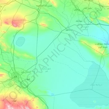
Name: Qomrud RD topographic map, elevation, terrain.
Average elevation: 3,028 ft
Minimum elevation: 2,523 ft
Maximum elevation: 7,297 ft
Other topographic maps
Click on a map to view its topography, its elevation and its terrain.
Qom
Iran > Qom Province > Qom County
Qom, Qom Central District, Qom County, Qom Province, Iran
Average elevation: 3,094 ft