
Chellala topographic map
Interactive map
Click on the map to display elevation.
About this map
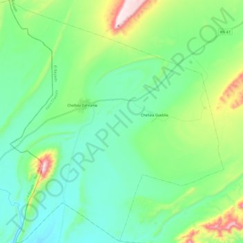
Name: Chellala topographic map, elevation, terrain.
Location: Chellala, daïra Chellala, El Bayadh, Algérie (32.92140 -0.01713 33.11444 0.18642)
Average elevation: 3,793 ft
Minimum elevation: 3,307 ft
Maximum elevation: 5,318 ft
Other topographic maps
Click on a map to view its topography, its elevation and its terrain.
El Mehara
Algérie > El Bayadh > daïra Chellala
El Mehara, daïra Chellala, El Bayadh, 32002, Algérie
Average elevation: 3,917 ft
Chellala Dahrania
Algérie > El Bayadh > daïra Chellala > Chellala
Chellala Dahrania, Chellala, daïra Chellala, El Bayadh, Algérie
Average elevation: 3,714 ft