
Ayapata topographic map
Interactive map
Click on the map to display elevation.
About this map
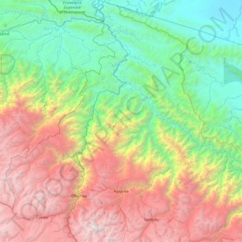
Name: Ayapata topographic map, elevation, terrain.
Location: Ayapata, Carabaya, Puno, Perú (-13.95349 -70.44035 -13.11441 -70.02575)
Average elevation: 6,942 ft
Minimum elevation: 755 ft
Maximum elevation: 18,904 ft
Other topographic maps
Click on a map to view its topography, its elevation and its terrain.
Challhuamayo
Perú > Puno > Ayapata > Challhuamayo
Challhuamayo, Ayapata, Provincia de Carabaya, Puno, Perú
Average elevation: 1,883 ft