
Premissel topographic map
Interactive map
Click on the map to display elevation.
About this map
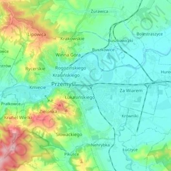
Name: Premissel topographic map, elevation, terrain.
Location: Premissel, Woiwodschaft Karpatenvorland, Polen (49.74646 22.71306 49.82064 22.85544)
Average elevation: 778 ft
Minimum elevation: 617 ft
Maximum elevation: 1,316 ft