Geolocate

Mount Busa topographic map

Click on the map to display elevation.

About this map

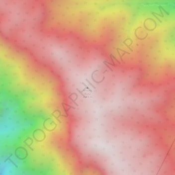
Name: Mount Busa topographic map, elevation, terrain.

Location: Mount Busa, Sarangani, Soccsksargen, Philippines (6.11856 124.68328 6.11866 124.68338)

Average elevation: 5,764 ft

Minimum elevation: 3,622 ft

Maximum elevation: 6,575 ft

Other topographic maps

Click on a map to view its topography, its elevation and its terrain.

Buayan River

Philippines > Sarangani > Kibala

Average elevation: 2,149 ft

Gear up for your next adventure:

🛰️Handheld GPS Units - Professional satellite navigators for precise backcountry mapping
🥾Men's Hiking Boots - Durable, waterproof footwear for rugged terrain and steep inclines
🖼️Topo Map Wall Art - Decorative topographic prints of famous peaks and regions
🕶️Glacier Sunglasses - Side shields to protect eyes from high-altitude snow glare
🌡️Portable Weather Meter - Track weather conditions on the trail

As an Amazon Associate, this site earns from qualifying purchases at no extra cost to you.