
Moraleja topographic map
Interactive map
Click on the map to display elevation.
About this map
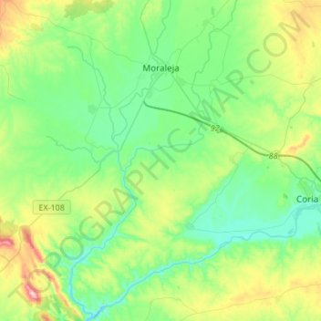
Name: Moraleja topographic map, elevation, terrain.
Location: Moraleja, Sierra de Gata, Cáceres, Estremadura, 10840, Espanha (39.90362 -6.77527 40.11126 -6.61777)
Average elevation: 1,001 ft
Minimum elevation: 650 ft
Maximum elevation: 1,972 ft