
Salluit (village) topographic map
Interactive map
Click on the map to display elevation.
About this map
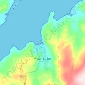
Name: Salluit (village) topographic map, elevation, terrain.
Location: Salluit (village), Kativik, Nord-du-Québec, Québec, Canada (62.17810 -75.67328 62.23960 -75.57693)
Average elevation: 331 ft
Minimum elevation: -3 ft
Maximum elevation: 1,440 ft