Geolocate

Ipplepen topographic map

Click on the map to display elevation.

About this map

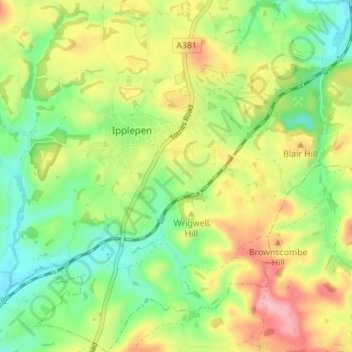
Name: Ipplepen topographic map, elevation, terrain.

Location: Ipplepen, Teignbridge, Devon, England, United Kingdom (50.46115 -3.66407 50.50507 -3.60205)

Average elevation: 233 ft

Minimum elevation: 43 ft

Maximum elevation: 495 ft

Other topographic maps

Click on a map to view its topography, its elevation and its terrain.

Water

United Kingdom > England > Devon > Teignbridge

Average elevation: 856 ft

Higher Ashton

United Kingdom > England > Devon > Teignbridge

Average elevation: 381 ft

Bovey Tracey

United Kingdom > England > Devon > Teignbridge

Average elevation: 358 ft

Gear up for your next adventure:

🎒Outdoor Daypacks - Lightweight backpacks designed for carrying maps and essential gear
🥤Water Filter Bottle - All‑in‑one filter bottle for safe hydration
🔌Solar Panel Charger - Charge gear sustainably outdoors
📶Vehicle Signal Boosters - Improve reception in rural areas while driving to trailheads
💧Water Purification System - Clean water on the trail with reliable purifiers

As an Amazon Associate, this site earns from qualifying purchases at no extra cost to you.