
Sugar Creek topographic map
Interactive map
Click on the map to display elevation.
About this map
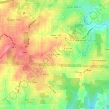
Name: Sugar Creek topographic map, elevation, terrain.
Location: Sugar Creek, Douglas County, Georgia, 30135, USA (33.68316 -84.77855 33.72316 -84.73855)
Average elevation: 1,102 ft
Minimum elevation: 925 ft
Maximum elevation: 1,253 ft