
Sector 3 topographic map
Interactive map
Click on the map to display elevation.
About this map
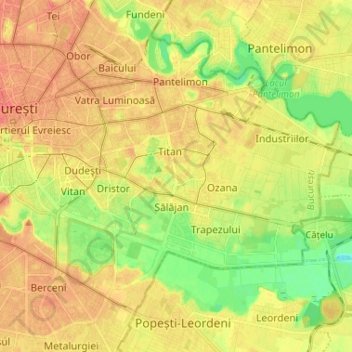
Name: Sector 3 topographic map, elevation, terrain.
Location: Sector 3, Bucharest, Romania (44.39378 26.09563 44.44255 26.22558)
Average elevation: 243 ft
Minimum elevation: 154 ft
Maximum elevation: 308 ft
Other topographic maps
Click on a map to view its topography, its elevation and its terrain.