
Rhêmes-Saint-Georges topographic map
Interactive map
Click on the map to display elevation.
About this map
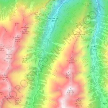
Name: Rhêmes-Saint-Georges topographic map, elevation, terrain.
Location: Rhêmes-Saint-Georges, Valle de Aosta, Italia (45.58824 7.10047 45.66938 7.18446)
Average elevation: 6,919 ft
Minimum elevation: 3,330 ft
Maximum elevation: 11,099 ft