
Eden topographic map
Click on the map to display elevation.
About this map
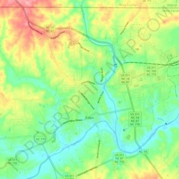
Name: Eden topographic map, elevation, terrain.
Location: Eden, Rockingham County, North Carolina, United States (36.47040 -79.78813 36.53379 -79.67971)
Average elevation: 627 ft
Minimum elevation: 489 ft
Maximum elevation: 846 ft
Rockingham County trails, hiking, mountain biking, running and outdoor activities
Other topographic maps
Click on a map to view its topography, its elevation and its terrain.