
Fatehpur Sikri topographic map
Interactive map
Click on the map to display elevation.
About this map
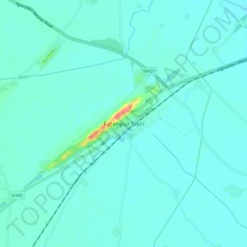
Name: Fatehpur Sikri topographic map, elevation, terrain.
Location: Fatehpur Sikri, Kiraoli, Agra, Uttar Pradesh, 283110, India (27.05117 77.62240 27.13117 77.70240)
Average elevation: 571 ft
Minimum elevation: 551 ft
Maximum elevation: 692 ft
Other topographic maps
Click on a map to view its topography, its elevation and its terrain.
Achhnera
India > Uttar Pradesh > Kiraoli
Achhnera, Kiraoli, Agra, Uttar Pradesh, India
Average elevation: 564 ft