
Veendam topographic map
Interactive map
Click on the map to display elevation.
About this map
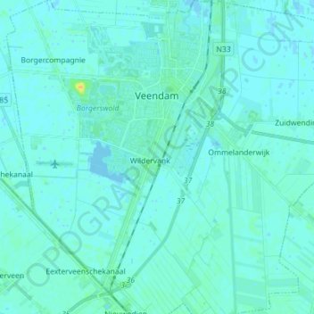
Name: Veendam topographic map, elevation, terrain.
Location: Veendam, Groningen, Nederland (53.04373 6.83106 53.12860 6.96191)
Average elevation: 7 ft
Minimum elevation: -7 ft
Maximum elevation: 62 ft
Other topographic maps
Click on a map to view its topography, its elevation and its terrain.