
Fontenais topographic map
Interactive map
Click on the map to display elevation.
About this map
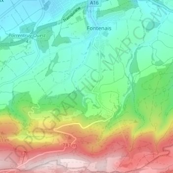
Name: Fontenais topographic map, elevation, terrain.
Location: Fontenais, District de Porrentruy, Jura, Suisse (47.36890 7.05149 47.41014 7.09660)
Average elevation: 1,946 ft
Minimum elevation: 1,414 ft
Maximum elevation: 2,979 ft
Other topographic maps
Click on a map to view its topography, its elevation and its terrain.
Bressaucourt
Suisse > Jura > District de Porrentruy > Fontenais
Bressaucourt, Fontenais, District de Porrentruy, Jura, 2904, Suisse
Average elevation: 2,073 ft