
Wannsee topographic map
Interactive map
Click on the map to display elevation.
About this map
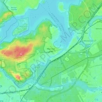
Name: Wannsee topographic map, elevation, terrain.
Location: Wannsee, Steglitz-Zehlendorf, Berlin, 14109, Germany (52.38723 13.08835 52.45220 13.18691)
Average elevation: 144 ft
Minimum elevation: 82 ft
Maximum elevation: 341 ft
Other topographic maps
Click on a map to view its topography, its elevation and its terrain.