
Carabanzo topographic map
Interactive map
Click on the map to display elevation.
About this map
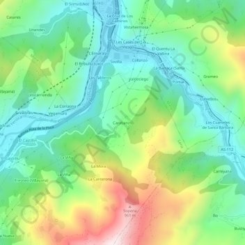
Name: Carabanzo topographic map, elevation, terrain.
Location: Carabanzo, Pola de Lena, 33640, España (43.16543 -5.80604 43.20543 -5.76604)
Average elevation: 1,585 ft
Minimum elevation: 764 ft
Maximum elevation: 3,271 ft