
Manila topographic map
Click on the map to display elevation.
Manila
Almost all of Manila sits on top of centuries of prehistoric alluvial deposits built by the waters of the Pasig River and on some land reclaimed from Manila Bay. Manila's land has been altered substantially by human intervention, with considerable land reclamation along the waterfronts since the American colonial times. Some of the city's natural variations in topography have been evened out. As of 2013, Manila had a total area of 42.88 square kilometers.
About this map
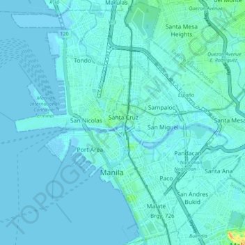
Name: Manila topographic map, elevation, terrain.
Location: Manila, Fifth District, Manila, Metro Manila, Philippines (14.55700 120.94169 14.63900 121.02617)
Average elevation: 20 ft
Minimum elevation: -3 ft
Maximum elevation: 223 ft
Other topographic maps
Click on a map to view its topography, its elevation and its terrain.