Geolocate

Gidole topographic map

Click on the map to display elevation.

About this map

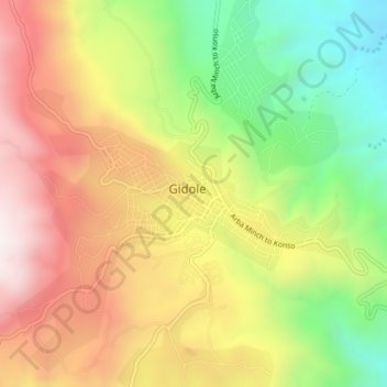
Name: Gidole topographic map, elevation, terrain.

Location: Gidole, Derashe Special Woreda, Southern Nations, Ethiopia (5.63000 37.34667 5.67000 37.38667)

Average elevation: 6,647 ft

Minimum elevation: 5,033 ft

Maximum elevation: 8,238 ft

Gear up for your next adventure:

🌡️Portable Weather Meter - Track weather conditions on the trail
🔭Compact Binoculars - HD vision for scouting terrain and identifying distant landmarks
👖Convertible Hiking Pants - Versatile zip-off pants for changing altitudes and temperatures
🪓Survival Multi‑Tool - Versatile tool for camp and trail tasks
🔊Portable Camp Speaker - Music and alerts at camp

As an Amazon Associate, this site earns from qualifying purchases at no extra cost to you.