
Colca topographic map
Interactive map
Click on the map to display elevation.
About this map
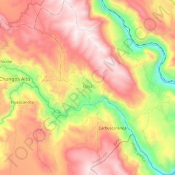
Name: Colca topographic map, elevation, terrain.
Location: Colca, Provincia de Huancayo, Junín, Perú (-12.39625 -75.27158 -12.24182 -75.12935)
Average elevation: 12,461 ft
Minimum elevation: 9,911 ft
Maximum elevation: 14,570 ft