
Bossangoa topographic map
Interactive map
Click on the map to display elevation.
About this map
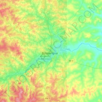
Name: Bossangoa topographic map, elevation, terrain.
Location: Bossangoa, Ouham, 42834, Central African Republic (6.33244 17.28632 6.65244 17.60632)
Average elevation: 1,634 ft
Minimum elevation: 1,424 ft
Maximum elevation: 1,998 ft