
Prades topographic map
Interactive map
Click on the map to display elevation.
About this map
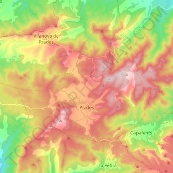
Name: Prades topographic map, elevation, terrain.
Location: Prades, Baix Camp, Tarragona, Catalonië, 43364, Spanje (41.28991 0.93589 41.35284 1.06431)
Average elevation: 2,848 ft
Minimum elevation: 1,719 ft
Maximum elevation: 3,911 ft
Other topographic maps
Click on a map to view its topography, its elevation and its terrain.
Mont-roig del Camp
Spanje > Catalonië > Baix Camp
Mont-roig del Camp, Baix Camp, Tarragona, Catalonië, 43300, Spanje
Average elevation: 394 ft