
中宁县 topographic map
Interactive map
Click on the map to display elevation.
About this map
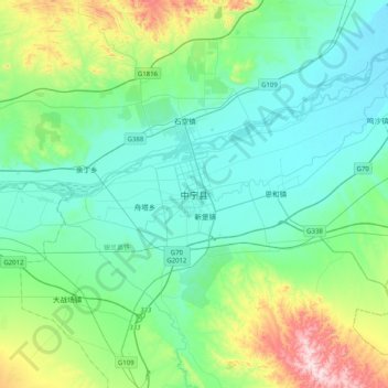
Name: 中宁县 topographic map, elevation, terrain.
Location: 中宁县, 中卫市, 宁夏回族自治区, 中国 (37.33152 105.51464 37.65152 105.83464)
Average elevation: 4,183 ft
Minimum elevation: 3,812 ft
Maximum elevation: 5,620 ft
Other topographic maps
Click on a map to view its topography, its elevation and its terrain.