
Thank you for supporting this site ❤️
Make a donation
Make a donation
Gear up for your next adventure:
As an Amazon Associate, this site earns from qualifying purchases at no extra cost to you.
Stallavena topographic map
Click on the map to display elevation.
Thank you for supporting this site ❤️
Make a donation
Make a donation
Gear up for your next adventure:
As an Amazon Associate, this site earns from qualifying purchases at no extra cost to you.
About this map
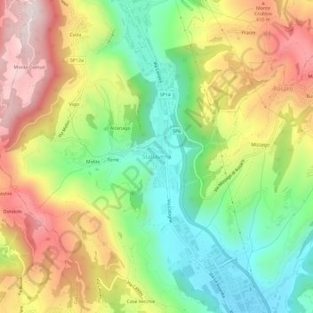
Name: Stallavena topographic map, elevation, terrain.
Location: Stallavena, Grezzana, Verona, Veneto, 37023, Italia (45.52304 10.98152 45.56304 11.02152)
Average elevation: 1,453 ft
Minimum elevation: 584 ft
Maximum elevation: 2,533 ft
Thank you for supporting this site ❤️
Make a donation
Make a donation
Gear up for your next adventure:
As an Amazon Associate, this site earns from qualifying purchases at no extra cost to you.