Geolocate

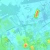
São Bento do Sul topographic map

Click on the map to display elevation.

About this map

Name: São Bento do Sul topographic map, elevation, terrain.

Location: São Bento do Sul, Região Geográfica Imediata de São Bento do Sul-Rio Negrinho, Região Geográfica Intermediária de Joinville, Santa Catarina, South Region, Brazil (-26.42600 -49.49073 -26.16197 -49.16939)

Average elevation: 2,575 ft

Minimum elevation: 171 ft

Maximum elevation: 3,691 ft

Other topographic maps

Click on a map to view its topography, its elevation and its terrain.

Tubarão

Brazil > Santa Catarina > Tubarão

Average elevation: 318 ft

Rio Amazonas

Brazil > Santa Catarina > Joinville

Average elevation: 39 ft

Gear up for your next adventure:

🧭Hiking Compass - Precision compass for reliable navigation in the wilderness
🧢Sun Protection Hats - Wide-brimmed and UPF-rated hats for high-altitude sun safety
🌡️Handheld Weather Meters - Measure wind, temp, and pressure for safe mountain travel
🧯Portable Fire Pit - Compact fire pit for camping spots
⛺Backpacking Tents - Weight-optimized shelters for multi-day topographic surveys

As an Amazon Associate, this site earns from qualifying purchases at no extra cost to you.