
Antey-Saint-André topographic map
Interactive map
Click on the map to display elevation.
About this map
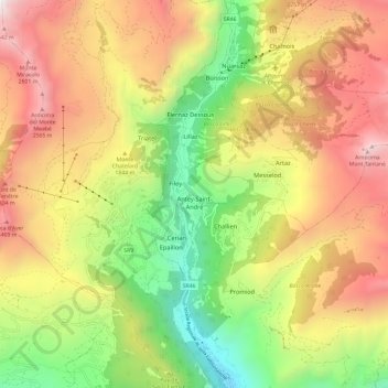
Name: Antey-Saint-André topographic map, elevation, terrain.
Location: Antey-Saint-André, Valle d'Aosta, 11020, Italia (45.76521 7.58110 45.84788 7.62698)
Average elevation: 5,653 ft
Minimum elevation: 2,201 ft
Maximum elevation: 9,347 ft