
Siblet topographic map
Interactive map
Click on the map to display elevation.
About this map
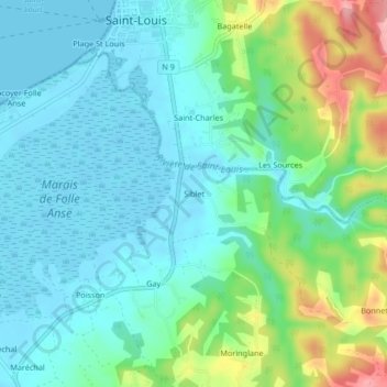
Name: Siblet topographic map, elevation, terrain.
Average elevation: 105 ft
Minimum elevation: -7 ft
Maximum elevation: 420 ft
Other topographic maps
Click on a map to view its topography, its elevation and its terrain.
Commobile
France > Guadeloupe > Grand-Bourg
Commobile, Grand-Bourg, Pointe-à-Pitre, Guadeloupe, 97112, France
Average elevation: 328 ft
Murat
France > Guadeloupe > Grand-Bourg
Murat, Grand-Bourg, Pointe-à-Pitre, Guadeloupe, 97112, France
Average elevation: 108 ft