
Bordj Boni topographic map
Interactive map
Click on the map to display elevation.
About this map
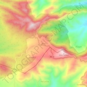
Name: Bordj Boni topographic map, elevation, terrain.
Location: Bordj Boni, Ighil Ali, Daïra Ighil Ali, Béjaïa, 06014, Algérie (36.24054 4.54427 36.28054 4.58427)
Average elevation: 3,524 ft
Minimum elevation: 2,592 ft
Maximum elevation: 4,304 ft