
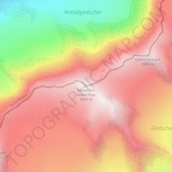
Ebnefluh/Äbeni Flue topographic map
Interactive map
Click on the map to display elevation.
About this map
Name: Ebnefluh/Äbeni Flue topographic map, elevation, terrain.
Location: Ebnefluh/Äbeni Flue, Fieschertal, Goms, Wallis, Switzerland (46.50798 7.95332 46.50808 7.95342)
Average elevation: 11,253 ft
Minimum elevation: 8,494 ft
Maximum elevation: 12,907 ft