
Maassluis topographic map
Interactive map
Click on the map to display elevation.
About this map
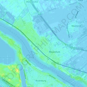
Name: Maassluis topographic map, elevation, terrain.
Location: Maassluis, Südholland, Niederlande (51.90534 4.21272 51.94799 4.29261)
Average elevation: 7 ft
Minimum elevation: -13 ft
Maximum elevation: 62 ft