
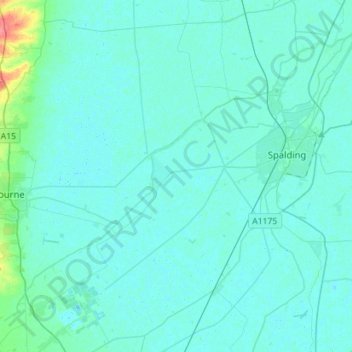
River Glen topographic map
Interactive map
Click on the map to display elevation.
About this map
Name: River Glen topographic map, elevation, terrain.
Average elevation: 16 ft
Minimum elevation: -3 ft
Maximum elevation: 174 ft
Other topographic maps
Click on a map to view its topography, its elevation and its terrain.
Donington CP
United Kingdom > England > Lincolnshire > South Holland
Donington CP, South Holland, Lincolnshire, England, United Kingdom
Average elevation: 10 ft
Spalding
United Kingdom > England > Lincolnshire > South Holland > Spalding
Spalding, South Holland, Lincolnshire, East Midlands, England, United Kingdom
Average elevation: 13 ft
Moulton Chapel
United Kingdom > England > Lincolnshire > South Holland > Moulton Chapel
Moulton Chapel, South Holland, Lincolnshire, East Midlands, England, PE12 0XQ, United Kingdom
Average elevation: 10 ft