
Río Chirripó Pacífico topographic map
Interactive map
Click on the map to display elevation.
About this map
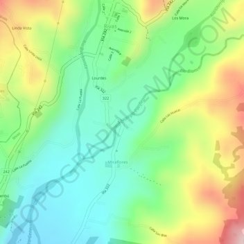
Name: Río Chirripó Pacífico topographic map, elevation, terrain.
Average elevation: 2,877 ft
Minimum elevation: 2,520 ft
Maximum elevation: 3,419 ft
Other topographic maps
Click on a map to view its topography, its elevation and its terrain.
Río Peñas Blancas
Costa Rica > Provincia San José > El General
Río Peñas Blancas, El General, Cantón Pérez Zeledón, Provincia San José, 11902, Costa Rica
Average elevation: 7,188 ft