Geolocate

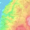
Zango III topographic map

Click on the map to display elevation.

About this map

Name: Zango III topographic map, elevation, terrain.

Location: Zango III, Viana Municipality, Luanda Province, Angola (-9.06810 13.39188 -9.02810 13.43188)

Average elevation: 492 ft

Minimum elevation: 456 ft

Maximum elevation: 512 ft

Other topographic maps

Click on a map to view its topography, its elevation and its terrain.
Luanda

Angola > Luanda Province > Municipality of Luanda

Average elevation: 144 ft

Luanda

Angola > Luanda Province > Municipality of Luanda

Average elevation: 144 ft

Luanda

Angola > Luanda Province > Municipality of Luanda

Average elevation: 144 ft

Viana Municipality

Angola > Luanda Province

Average elevation: 308 ft

Talatona Municipality

Angola > Luanda Province

Average elevation: 210 ft

Luanda

Angola > Luanda Province > Municipality of Luanda

Average elevation: 144 ft

Municipality of Quiçama

Angola > Luanda Province

Average elevation: 525 ft

Luanda

Angola > Luanda Province > Municipality of Luanda

Average elevation: 144 ft

Talatona Municipality

Angola > Luanda Province

Average elevation: 210 ft

Cazenga Municipality

Angola > Luanda Province

Average elevation: 226 ft

Municipality of Belas

Angola > Luanda Province

Average elevation: 180 ft

Municipality of Belas

Angola > Luanda Province

Average elevation: 180 ft

Luanda

Angola > Luanda Province > Municipality of Luanda

Average elevation: 144 ft

Luanda

Angola > Luanda Province > Municipality of Luanda

Average elevation: 144 ft

Cacuaco Municipality

Angola > Luanda Province

Average elevation: 220 ft

Luanda

Angola > Luanda Province > Municipality of Luanda

Average elevation: 144 ft

Luanda

Angola > Luanda Province > Municipality of Luanda

Average elevation: 144 ft

Gear up for your next adventure:

📌Outdoor GPS Map App - Apps and devices for digital topographic navigation
🍳Camping Cook Set - Complete cookware for outdoor meals
☕Camping Coffee Makers - Enjoy premium coffee at the summit or campsite
🏫Relief Map Kits - Hands-on tools for teaching landforms and elevation
🔦Compact Flashlight - Reliable flashlight for emergencies

As an Amazon Associate, this site earns from qualifying purchases at no extra cost to you.