
Bishopville topographic map
Interactive map
Click on the map to display elevation.
About this map
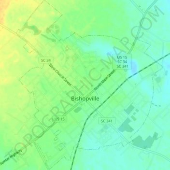
Name: Bishopville topographic map, elevation, terrain.
Location: Bishopville, Lee County, South Carolina, United States (34.20462 -80.26435 34.23692 -80.23056)
Average elevation: 223 ft
Minimum elevation: 187 ft
Maximum elevation: 269 ft