
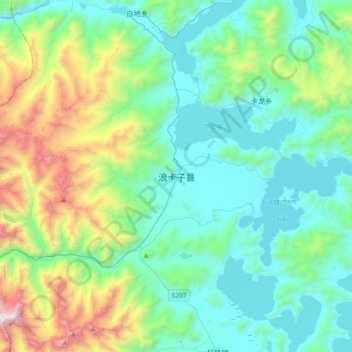
浪卡子县 topographic map
Interactive map
Click on the map to display elevation.
About this map
Name: 浪卡子县 topographic map, elevation, terrain.
Location: 浪卡子县, 浪卡子镇, 浪卡子县, 山南市, 西藏自治区, 中国 (28.80670 90.23637 29.12670 90.55637)
Average elevation: 15,988 ft
Minimum elevation: 14,478 ft
Maximum elevation: 21,407 ft