
江口县 topographic map
Interactive map
Click on the map to display elevation.
About this map
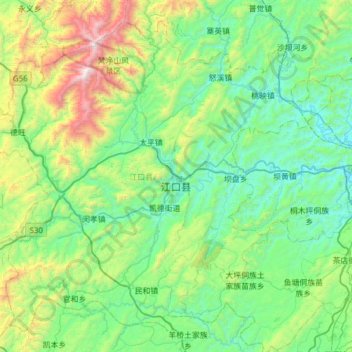
Name: 江口县 topographic map, elevation, terrain.
Location: 江口县, 铜仁市, Guizhou, 558000, Chine (27.47712 108.49288 27.95598 109.10848)
Average elevation: 2,539 ft
Minimum elevation: 889 ft
Maximum elevation: 8,268 ft