
Thank you for supporting this site ❤️
Make a donation
Make a donation
Gear up for your next adventure:
As an Amazon Associate, this site earns from qualifying purchases at no extra cost to you.
Quinsaloma topographic map
Click on the map to display elevation.
Thank you for supporting this site ❤️
Make a donation
Make a donation
Gear up for your next adventure:
As an Amazon Associate, this site earns from qualifying purchases at no extra cost to you.
About this map
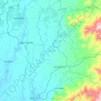
Name: Quinsaloma topographic map, elevation, terrain.
Location: Quinsaloma, Los Ríos, Ecuador (-1.33488 -79.42332 -0.95762 -79.28674)
Average elevation: 833 ft
Minimum elevation: 82 ft
Maximum elevation: 5,945 ft
Thank you for supporting this site ❤️
Make a donation
Make a donation
Gear up for your next adventure:
As an Amazon Associate, this site earns from qualifying purchases at no extra cost to you.